King Alfred's Monument

On a low mound in the Somerset Levels near Athelney there is a monument to King Alfred. In January 878 the Viking king Guthrum launched a surprise attack on Alfred at Chippenham, and King Alfred was forced to fall back, to Athelney in the Somerset Levels. King Alfred took refuge at an old Iron age hillfort, and here he planned his reprisal. In May of the same year he launched the fierce battle of Edington, where Alfred vanquished Guthrum's Viking army, the remnants withdrew to Chippenham and surrendered.
 |
| King Alfred's monument |
Guthrum converted to Christianity an Alfred became king of Wessex, which is the start of what we now know as England. In 888 Alfred built a monastery on this site, which was destroyed in the Dissolution of the monasteries, so now this monument is all that can be seen. It was built in 1801 by John Slade.
 |
| Bust of King Alfred on the monument |
The inscription reads
“King Alfred the Great in the year of Our Lord 879 having been defeated by the Danes, fled for refuge to the Forest of Athelney, where he lay concealed from his enemies for the space of a whole year. He soon after regained possession of his throne, and in grateful remembrance of the protection he had received under the favour of Heaven, erected a monastery on this spot and endowed it with all the lands contained in the Isle of Athelney to perpetuate the memorial of so remarkable an incident in the life of that illustrious prince this edifice was founded by John Slade, Esq. of Mansel [Maunsel House], the proprietor of Athelney Farm and lord of the manor of North Petherton”
 |
| King Alfred's monument - the rise in the ground meant Alfred could take refuge here in the marshes |
Drainage is still a big deal here - the Environment Agency has a big flood control centre and pumping station near to the bridge over the river Tone. In Alfred's day this would have been an island in the marshland. There's a good view of Burrow Mump in the distance
 |
| Burrow Mump from King Alfred's monument |
though this was the forest of Athelney back then, so the view may not have been so clear, and there was, of course, no church, ruined or otherwise on the top.

The monument is on private land, and it's good of them to allow access to it. I found this hard to locate. The references I found showed access down the farm track, but they kindly redirect you to the footpath along the river Tone. By the looks of it, the access has been this way for over 20 years ;)
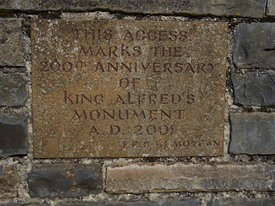 |
| Sign for the 'new' access route |
 | |
| They take great pains to tell you this is a permissive footpath that can be ceased at any time |
The track I followed, on Google maps:
In principle you should also be able to reach the monument from the A361, via the track starting at ST347295 but I haven't tried that. It looks a tough 50m walk along the road from the layby on the A361 and you can just about see the monument on Google Streetview from it


Comments